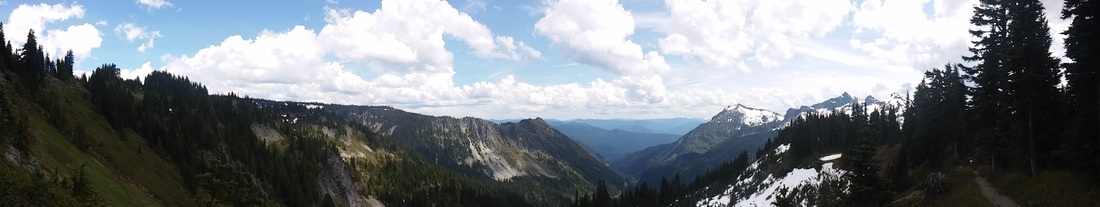
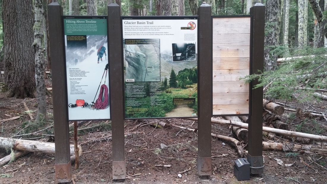
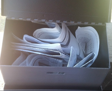
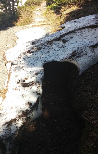
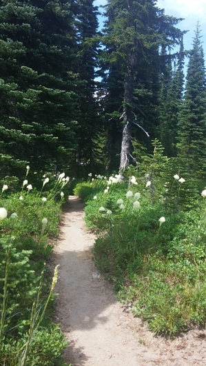
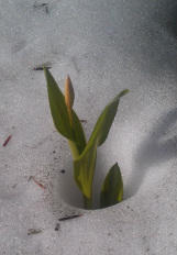
Well summer is in full swing on Mt. Rainier! The sun is shining, birds are chirping and trails are snow free! The snow is almost all the way melted at our sites and some flowers are already up. The only site that still had some snow was site 9 and it was only half covered on June 9th. For MeadoWatch that means we need your data now more than ever. The two data drop boxes have been installed, one at L112 behind the Wilderness Information Center and the newest one is installed on the Glacier Basin Trail map, just as you start down the trail. Feel free to deposit your data in either of these drop boxes. If you would like to camp at White Rive campground or at the Historic Longmire Campground, please let me know at least 2 weeks in advance with how many night you would like to stay (max of 2) and how many people will be in your party. Looking forward to seeing you on the trail! |
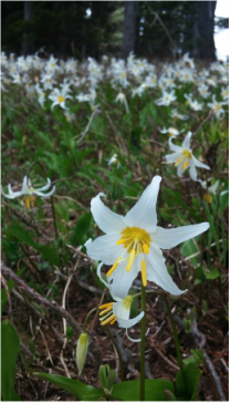
2 Comments
We have found a location for our data drop box!
It is at the beginning of the Glacier Basin Trail, attached to the map display. Photo attached! Thanks for an incredible second year of MeadoWatch, we truly couldn't have done it without you! The time we've all been waiting for is here! The wildflowers have hit peak flowering! The meadows are gloriously full of every imaginable color. When I hiked the trail last week the mountain was being shy, but here is view from plot 6. I hope everyone has been enjoying their hikes, it has been a slow start but the wait is worth it for these wildflower displays!
If you are loving MeadoWatch and want more citizen science ideas, check out these projects that are going on right here at Mt. Rainier!
Cascade Butterfly Project The Cascades Butterfly Project is a long-term citizen science project that monitors butterfly populations in North Cascades National Park and Mount Rainier National Park. Subalpine meadows in these two National Parks are expected to shrink dramatically due to the effects of climate change, but as of now, the rate and magnitude of this change is unknown. Butterflies make ideal indicator species because they are particularly sensitive to climatic changes, and are relatively easy to identify in the field by scientists and volunteers alike. Participants will hike up into some of this country’s most scenic alpine meadows and help scientists identify and count the butterflies along the way. https://groups.yahoo.com/neo/groups/cascadesbutterfly/info Amphibian Monitoring We are looking for volunteers to help conduct amphibian surveys to document the presence or absence of amphibian species at various lakes, ponds and wetlands with an emphasis on historical Western Toad sites. Volunteers will be part of a small group. We will hike to chosen sites and conduct amphibian surveys. This primarily involves finding, identifying and measuring amphibians at all stages of development. You do not need any previous experience and surveying equipment will be provided. You may volunteer once or multiple times throughout the season. If you need to stay overnight, free camping is available at Cougar Rock, White River, Ohanapecosh and Longmire campgrounds, however, I recommend Longmire since it is the closest to our meeting point. We are conducting both day trip and overnight backpacking surveys throughout the park, as some lakes are much easier to get to than others. More detailed information will be provided once volunteers have been confirmed. If you are interested in helping with this project, please contact Laura at laura_davis@partner.nps.gov. Cascade Carnivores I am looking for dedicated hikers to choose from one to a few trails to hike along and collect carnivore scats this summer. In order to join this citizen science effort, you will need to commit to a minimum of 3 hikes between July.1 and September.30. You are free to select for any 3 dates that work for you within in this timeframe. If you want to do them all together, you will want to sign up for 3 different trails. Or if you would like to sign up for 3 well-spaced dates, you can chose the same trail and hike it 3 times (or 3 different ones....however you decide). There will be no formal training for this position. I will send you supplies and our field protocol to guide you and am available for phone discussions. As a scat collector, you will hike, photograph, and collect any putative mountain red fox, wolverine, and gray wolf scat for DNA analysis in order to investigate the conservation status and connectivity of these rare carnivores in the Cascade Range. It will be super helpful if you have a GPS and camera but they are not necessary. If you are interested in becoming a citizen scientist, select the trail(s) you would like to steward from the attached list and sign up by replying to cascadescarnivore@gmail.com with the trail name(s) and # of times (1 to 3, or more) you will hike them. If you have sighted a mountain red fox, wolverine, or gray wolf in the Washington or Oregon Cascades, or would like to suggest a trail you think might be a good spot to detect one, I would love to hear about it. Please forward this email to any friends you think might be interested in joining the project. Also please sign up for our blog postings here to learn more about the Cascades Carnivore Project. Jocelyn Akins, PhD Candidate Project Coordinator, Cascades Carnivore Project http://cascadescarnivoreproject.blogspot.com/ 541.399.6348 Happy Volunteering! -Anna I hope everyone has been enjoying their somewhat snowy hikes! The trail is melting, slowly but surely, and wildflowers are popping up daily. I hiked last week on July 17th and had a lovely time hiking in the snow. Please remember to watch out for dangerous snow bridges and try to stay as close to the trail as possible when walking over snow. We don't want to cause resource damage by inadvertently making a new trail. The latest trail update from Carol Miltimore is that the trail is snow free to plot 4 and about 50% snow covered to plot 9.
Thanks for all the wonderful data and trail updates so far! You all are doing a wonderful job documenting snow presence and absence. Some updates on NPS Construction (Check this website before you plan to hike, as it is updated it weekly): http://www.nps.gov/mora/parkmgmt/nisqually-paradise-road.htm In other news, I saw 2 fawns along the road last week and they were extremely adorable! I'm hoping to see the grouse family very soon. Comment below if you've had any wildlife sightings this year! Check out this amazing new map to forecast when peak flowering will occur. A colleague of ours, Mark Raleigh, has developed a snow and wildflower forecast viewer. It uses the Google Earth interface which allows you to zoom in and out of precise areas. This is a super exciting tool because you are able to view snow disappearance dates, and peak flowering dates for many of our focal species. It is still a work in progress, so we would love feedback on what you like and what you think needs improving. Take a look at the Interactive Map and tell us what you think in the comments!
*You do need to have the Google Earth plugin installed on your browser, but that only takes a minute.
Once again, thanks to everyone who participated in this summer's inaugural season of MeadoWatch. You all are such great volunteers, and we couldn't do it without you! If you did not participate this year but would like to participate in MeadoWatch next year, sign up on our email list here: Email List All veteran volunteers will receive an email in the spring when we start planning for the summer. See you next season! Our year end newsletter is posted below to anyone who didn't get it or would like to see our preliminary results. As the season winds down, I wanted to recap all the incredible animal sightings we have had during MeadoWatch. Many of you have shared these experiences, which I love hearing about! Some of the animal experiences you have shared with me include:
|
Archives
August 2018
|