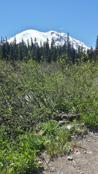
The hiking season is nearly upon us (the hike calendar opens tomorrow, June 30th)! Our Glacier Basin hike is always our first hike to melt out (the east side of the park gets about half of the snow that the south side gets), and this year is no exception. As of June 21, about half of this 3 mile hike was snow free, and hikers willing to travel over snow can reach the end of the hike. Tall Bluebell was already budding at our lower elevation plots as of a week ago (and may be flowering by now!), so there is plenty of data to collect!
A few notes about the Glacier Basin hike:
We will be out next week to place more trail markers, and hope to see you on the trails!
A few notes about the Glacier Basin hike:
- The MeadoWatch data collection box has been placed at Glacier Basin! it is ready to receive your data.
- Plots 1, 2 (see picture below), 3, 4, 5, and 8 have trail markers out as of June 21st. We will mark more of the plots next week (Thursday, July 6th), but it may take a while for us to get them all marked...
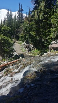
- A stream between plots 2 and 3 is briefly part of the trail – be prepared for wet socks! It should become easily passable in late summer as snowmelt amounts go down.
- An avalanche occurred right before plot 8! It has been cleared and is passable.
We will be out next week to place more trail markers, and hope to see you on the trails!


 RSS Feed